Back in 01851, the notable mapmaker James Wyld created a giant (60ft ~18.5m) globe in Leicester Square, London, England. It was there for nearly 11 years and built to capitalize on the Great Exhibition tourism. His globe was unique in that the map was rendered on the inside of the sphere rather than the outside. The projection on the globe matches that of the Earth so everything is scaled and positioned correctly.
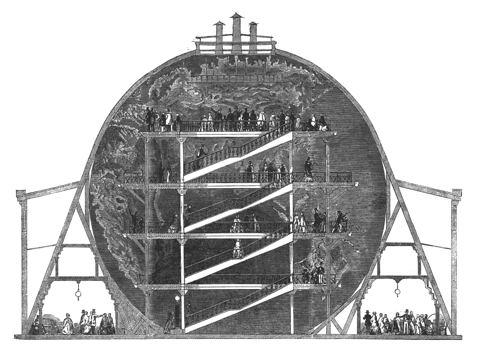
You’d enter and ascend stairs to various viewing platforms. From there you can see the globe from various angles. Being on a sphere reduces the distortion you’d get from various other maps that over-emphasizing the poles compared to the equator.
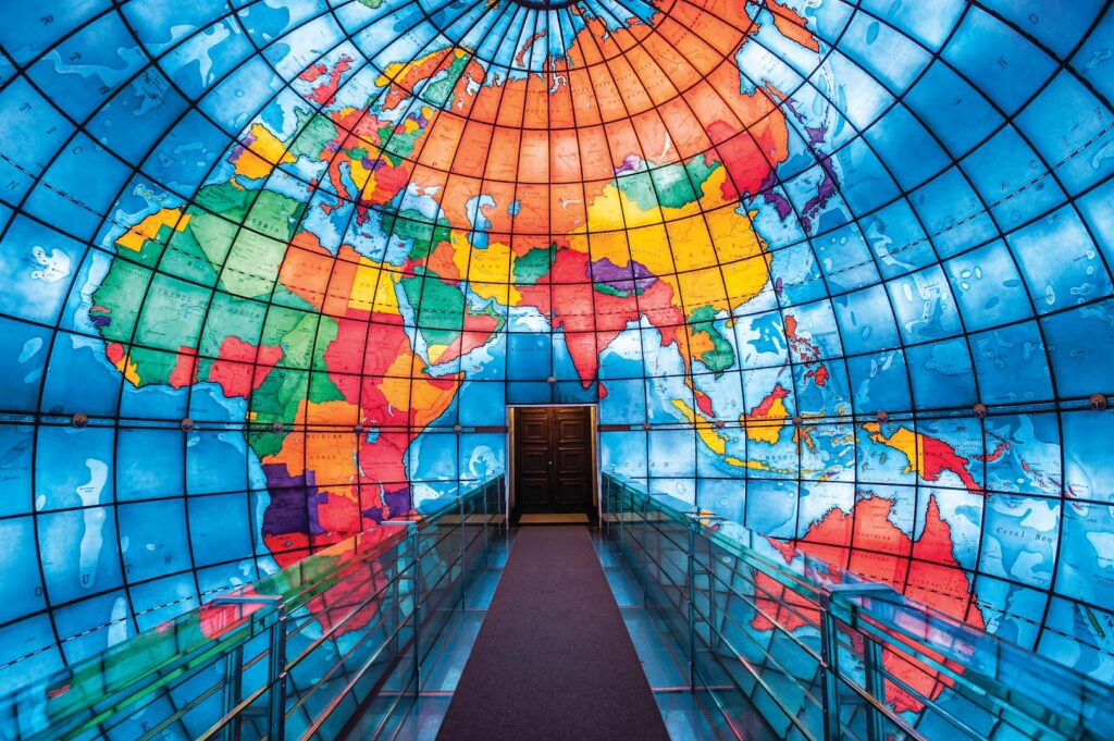
Over time, interest in Wyld’s Great Globe decreased until closure. Today, the Mapparium in Boston is the only globe you can enter and view from the inside. It was built in 01935 and is only half the diameter of Wyld’s.
These are unique experiences which change the way you look at and understand our Earth. We wanted to explore if it was possible to recreate this experience digitally using Virtual Reality.
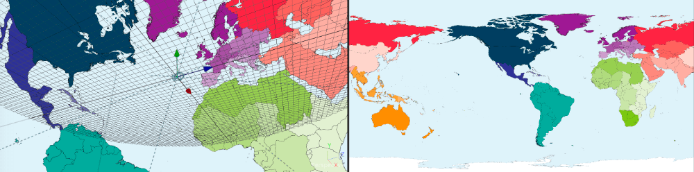
For other projects we’ve wrapped 180 and 360 images onto the inside of a sphere, so it should be simple todo the same thing with a 2D map using the right projections.
Working with the Worldmapper team, we took several of their equalrectangular projection maps and put them into a sphere in Virtual Reality. With a VR headset, you can look around 360 degrees, and simulate being inside a globe with the map rendered on the inside surface.
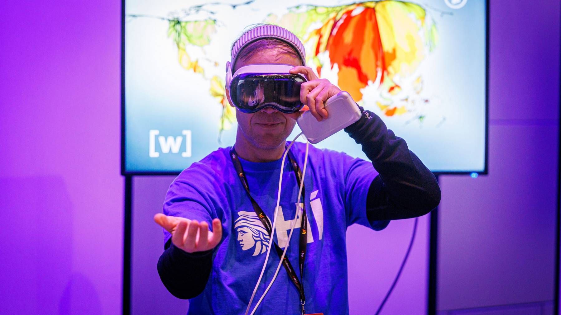
The Worldmapper team have worked extensively with various datasets to warp and bulge countries, regions and continents based on the data. Rather than the country being represented on the globe based on their square meterage, it is possible to visualize it based on population, tree coverage, mobile phone usage, and more.
Seeing all the different data sets as flat 2D images is interesting, but seeing them rendered all around you in a sphere is much more impactful!
We packaged everything-up in an app for the Apple Vision Pro. There you can select from a list of categories to view the cartograms as if you were standing inside the globe.
Technically, if you were on the inside of the Earth looking at the underside of the continents, you should see them reversed to what you’d expect on a globe. We tested this, but the reaction wasn’t positive; people need the shapes and outlines they are used too to orient themselves. So we applied the maps to the inside the sphere ‘mirrored’ so they look ‘correct’.
As part of an outreach exhibition, we created a short looping video of several maps crossfading between each other. There were 10 or so static maps by Worldmapper and NASA and one animated ‘heartbeat‘ map. Since they were all in equalrectangular projection, we could use some VR video playback software to play this 2D video as if it were 360 degrees.
The looping video isn’t as nice as a dedicated app where you can select the topic and explore as long as you’d like, but it works in all places that you can view 360 images. This makes demoing on other VR devices, and even smart phones with accelerometers, quick and easy; you pick it up, look for a bit and put it down when you’re done.
The reception was great, we learnt a lot and will continue to improve the app designs and cartograms. These tools help the Worldmapper team expand their offerings: from 2D printed postcards, to touch screen interactive maps, to a 360 VR movie, and 360 VR interactive cartograms. As a tool for outreach these VR experiences are proving popular. They give a certain 💯 factor that’s hard to recreate elsewhere.
How many chances do you get to stand at the center of Earth and explore the continents?